Tue
14 Jul
Activity
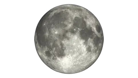
Moon Phase
new
Moonrise
7:28am
Major Windows
11:09am – 1:09pm
11:40pm – 1:40am
Minor Windows
6:28am – 8:28am
3:55pm – 5:55pm
Solunar, Tides & Weather
Today's Werribee River Mouth fishing forecast is based on the current solunar and weather signals. Drizzle may slightly improve feeding. Especially during solunar bite periods.
Updated
Moon Phase
New
Estimated Fish Feeding Activity
83%
Possible bite intensity is 83%, suggesting excellent fishing conditions.
Daily Timing
Current data for Werribee River Mouth place conditions in the excellent range at 83% potential bite intensity.
Solunar Score Today
83% Potential Bite (Feeding) Intensity
Major 1
11:09 – 13:09
Centre · 12:09
Strength · 100%
Overhead transit major
Major 2
23:40 – 01:40
Centre · 00:40
Strength · 54.8%
Underfoot transit major
Minor 1
06:28 – 08:28
Centre · 07:28
Strength · 32%
Moonrise minor
Minor 2
15:55 – 17:55
Centre · 16:55
Strength · 28.9%
Moonset minor
7 Day Solunar Forecast
Compare daily bite activity, major feeding windows and moon conditions to help plan upcoming fishing sessions.
7 Day Tides
Weather
Conditions here can shift quickly through the day, so use this as the broad weather picture alongside the separate wind and pressure sections below.
Right now
Light Drizzle
10.7°C
Today
Maximum
15.1°C
Minimum
8.8°C
Rain
1.1 mm
Pressure
Pressure is most useful when it shows movement. A stable, rising, or falling trend can add context to the rest of today’s fishing forecast.
Right now
Interpretation
Pressure changes tend to matter more than the absolute value, especially when conditions are shifting.
Pressure is only one signal. Wind, tide, solunar timing, water movement, and local structure still matter.
Recent readings build the pressure trend used for interpretation.
Wind
Wind direction and strength can change how exposed a location feels, especially around open water, beaches, piers, and headlands.
Right now
Current speed
15.9 km/h
Direction
NW
Today max
30.6 km/h
Reading the wind
Wind direction and strength can affect comfort, casting, and exposure around this location.
Wind gusts can be stronger than the average wind speed, so it's worth checking the gust forecast if you're planning to fish from an exposed location or need to know about potential changes in conditions.
Even modest wind can affect comfort and casting, especially where the water is exposed.
The marker shows the current wind direction, while the daily outlook below shows whether conditions are likely to build or ease over the coming days.
Marine Conditions
Marine forecasts are guidance only. Conditions can change quickly on exposed water.
Current marine state
Current wave
0.60 m
Max wave
0.82 m
Wave period
6.00 s
Swell
0.50 m
Wind wave
0.74 m
Water temp
12.0 C
Marine interpretation
Wave readings indicate conditions that should remain manageable for many anglers.
Marine caution
Higher waves suggest a conservative approach, especially in exposed areas. Forecast wave heights are averages rather than peak conditions. Individual waves may exceed the forecast height at times. Wind and local chop can quickly affect comfort and control. Wave period around 6.40 s can influence how conditions feel on the water. Conditions in open water can change quickly, so keep checking throughout the session.
Water temperature
Water temperature is around 12.0 C, making immersion a more significant factor to plan for. Cool or cold water can affect grip, coordination, and swimming ability. Hypothermia is a real risk, particularly if you become immersed in the water. Wind and rough water can increase the impact of an accidental immersion.
Check local marine warnings, ramps, vessel limits and current conditions before heading out.
Fishing Reports
Recent catch activity for this location.
Reports analysed
3
This year
3
This season
0
Species mentioned
2
Reported species
Snapper stands out in Werribee River Mouth reports, with Black Bream also showing up regularly.
This summary is based on reports tied to this location and is intended to assist using the species chart.
Based on local Getfished fishing report species data.
* Note that report summaries will sometimes display the same species under different names. This is because they are being reported that way. This is intentional.
Share of the displayed top 2 species mentions for this location.
Werribee South River Mouth is an estuary-to-bay fishing spot where the Werribee River meets Port Phillip Bay. Shore-based anglers have the river entrance Werribee South Pier and nearby bank access, while boaters use the Werribee South boat ramp to move through the river mouth into deeper bay water.
The entrance is open and the boating channel is marked, which makes it useful for both small and larger vessels when conditions and ramp usability are suitable. Parking is supported as good and free, and road access from the Princes Freeway is direct. The pier can suit families, but it can become busy, so an early start is worth considering, especially when fishing with children who need close supervision around the water.
Weed is a major factor at this location. It can affect the river, the pier, the ramps and the river channel, and it can reduce usability for average to larger boats when the area has not been dredged or maintained well. Shore anglers should expect weed to interfere with bait presentation and cause snagging, particularly around the pier and during spring after winter growth. The river entrance also gives boaters access to bay fishing for snapper, pinkie snapper, calamari, Australian salmon and flathead, while the river itself can produce bream and other estuary fish when conditions line up. Fertiliser runoff has been linked with occasional fish kills, so water condition and any visible signs of poor water quality are worth taking seriously.
For land-based fishing, work with the weed rather than pretending it is not there. Weedless presentations are useful when the river is thick with growth, and bait needs to be managed so it does not drag straight into snaggy patches. Pippis, bluebait, pilchards, whitebait, prawns, worms after rain and chicken breast are all supported bait options here. Paternoster and running sinker rigs both suit the location, with paternoster rigs especially useful for keeping smaller baits such as pippis controlled above the bottom. Berley can help draw fish through the river system, but it should be used with enough restraint that it does not create mess around a busy family pier.
A 7 to 9 foot estuary-style spinning rod is a practical fit for this water. Main line around 10 to 20 lb is supported, with lighter options more workable when a leader is used. The extra strength is useful because weed, snags and mixed estuary conditions are recurring issues here.
The river mouth is also home to the multi-lane Werribee Boat Ramp. While over the years launching has been variable the biggest problem faced is usually weed build up in the waters around the ramp. Fouling props and making launching quite difficult. This is dredged from time to time.
Trailier parking is now free and an extensive trailer parking area is provided with some overflow parking catered for.
The toilets are generally not kept in a pleasant condition. This, like the boat ramp, varies at times.
The car parking is free and there is a nice picnic area and childrens playground near the river beach front. From this perspective it is a great place for families.
No. Because a forecast cannot truthfully guarantee whether fish are biting at a specific spot right now. Getfished shows the current fishing conditions instead: tide movement, solunar timing, weather, wind, pressure, marine conditions and fising report, derived, species history.
Use this information to make informed decisions about where to fish, and to compare conditions across nearby locations. We hope you enjoy using Getfished to find your next great fishing spot!
| Werribee River Mouth is also known by these names: | Werribee estuary Werribee boat ramp Werribee river beach |
|---|---|
| Latitude | -37.9579 |
| Longitude | 144.715
View on Google Maps |
| Nearest city | Melbourne |
| Distance | 37.41 km |
| Platform | Estuaries |
| Bays | Port phillip bay |
| Rivers | Werribee river |
Nearby options
A small selection of other saltwater locations from the same region.
Fishing report summaries are derived from Getfished’s structured fishing report database system. More information on this on how we collect and structure fishing report data can be found on our Fishing reports information.
Forecasts are based on the Getfished Meteorological and Solunar Forecasting System, which combines data from the BOM, and other sources. Our custom software systems use these inputs to establish solunar, tides and other forecasts for fishing conditions.
For more information on our systems and data sources please see our Datasources page. You can also Contact us for more information or details on commercial reuse.