Solunar, Tides & Weather

Mordialloc Creek Fishing Times, Tides, Weather & Reports

Today's Mordialloc Creek fishing forecast is based on the current solunar and weather signals. Light precipitation; often fishable with minimal impact.

Updated

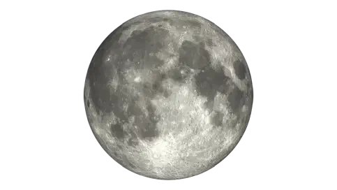
Moon Phase

New

Estimated Fish Feeding Activity

83%

Possible bite intensity is 83%, suggesting excellent fishing conditions.

Current Bite · Minor · 8:27am
Current Weather · Light Drizzle 10.9 C
Pressure · 1019 hPa
Sunrise · 7:33am
Sunset · 5:16pm
Next Tide · Low · 06:28

Daily Timing

Solunar

Current data for Mordialloc Creek place conditions in the excellent range at 83% potential bite intensity.

Solunar Score Today

83% Potential Bite (Feeding) Intensity

Major Bite Windows

Major 1

11:07 – 13:07

Centre · 12:07

Strength · 100%

Overhead transit major

Major 2

23:38 – 01:38

Centre · 00:38

Strength · 53.8%

Underfoot transit major

Minor Bite Windows

Minor 1

06:27 – 08:27

Centre · 07:27

Strength · 30.8%

Moonrise minor

Minor 2

15:54 – 17:54

Centre · 16:54

Strength · 27.5%

Moonset minor

7 Day Solunar Forecast

Plan upcoming fishing windows across the week

Compare daily bite activity, major feeding windows and moon conditions to help plan upcoming fishing sessions.

Tue

14 Jul

83%

Activity

Moon Phase

new

Moonrise

7:27am

Major Windows

11:07am – 1:07pm

11:38pm – 1:38am

Minor Windows

6:27am – 8:27am

3:54pm – 5:54pm

Wed

15 Jul

75%

Activity

Moon Phase

new

Moonrise

8:15am

Major Windows

12:38am – 2:38am

12:10pm – 2:10pm

Minor Windows

7:15am – 9:15am

5:12pm – 7:12pm

Thu

16 Jul

59%

Activity

Moon Phase

new

Moonrise

8:53am

Major Windows

1:32am – 3:32am

1:07pm – 3:07pm

Minor Windows

7:53am – 9:53am

6:29pm – 8:29pm

Fri

17 Jul

52%

Activity

Moon Phase

waxing crescent

Moonrise

9:24am

Major Windows

2:22am – 4:22am

1:58pm – 3:58pm

Minor Windows

8:24am – 10:24am

7:41pm – 9:41pm

Sat

18 Jul

48%

Activity

Moon Phase

waxing crescent

Moonrise

9:51am

Major Windows

3:08am – 5:08am

2:46pm – 4:46pm

Minor Windows

8:51am – 10:51am

8:50pm – 10:50pm

Sun

19 Jul

47%

Activity

Moon Phase

waxing crescent

Moonrise

10:15am

Major Windows

3:53am – 5:53am

3:31pm – 5:31pm

Minor Windows

9:15am – 11:15am

9:55pm – 11:55pm

Mon

20 Jul

44%

Activity

Moon Phase

1st quarter

Moonrise

10:39am

Major Windows

4:37am – 6:37am

4:15pm – 6:15pm

Minor Windows

9:39am – 11:39am

7 Day Tides

Tide timing and movement through the week

Next tide: Lowat 06:28· 0.15 m

Mon

13 Jul

4 tides

Low

06:28

0.15 m

High

13:45

0.78 m

Low

18:42

0.62 m

High

23:46

0.84 m

Tue

14 Jul

3 tides

Low

07:43

0.11 m

High

15:01

0.82 m

Low

20:19

0.61 m

Wed

15 Jul

4 tides

Low

08:52

0.09 m

High

01:09

0.81 m

Low

21:34

0.56 m

High

16:01

0.85 m

Thu

16 Jul

4 tides

Low

09:55

0.08 m

High

02:34

0.79 m

Low

22:35

0.50 m

High

16:50

0.87 m

Fri

17 Jul

4 tides

Low

10:52

0.10 m

High

03:50

0.79 m

Low

23:28

0.44 m

High

17:33

0.88 m

Sat

18 Jul

3 tides

Low

11:43

0.15 m

High

04:57

0.79 m

High

18:12

0.88 m

Sun

19 Jul

4 tides

Low

00:17

0.38 m

High

05:58

0.79 m

Low

12:29

0.20 m

High

18:46

0.89 m

Weather

Current conditions and 7 day outlook

Conditions here can shift quickly through the day, so use this as the broad weather picture alongside the separate wind and pressure sections below.

Right now

Light Drizzle

10.9°C

Today

Maximum

14.5°C

Minimum

10.9°C

Rain

2.0 mm

Tue

14 Jul

Light Drizzle

Range

10.9°C to 14.5°C

Rain

2.0 mm

Wed

15 Jul

Light Drizzle

Range

8.2°C to 14.1°C

Rain

0.2 mm

Thu

16 Jul

Overcast

Range

9.7°C to 13.7°C

Rain

0.0 mm

Fri

17 Jul

Overcast

Range

6.6°C to 14.2°C

Rain

0.0 mm

Sat

18 Jul

Overcast

Range

4.7°C to 12.3°C

Rain

0.0 mm

Sun

19 Jul

Overcast

Range

4.7°C to 15.7°C

Rain

0.0 mm

Mon

20 Jul

Overcast

Range

8.0°C to 14.8°C

Rain

0.0 mm

Pressure

Barometric pressure

Pressure is most useful when it shows movement. A stable, rising, or falling trend can add context to the rest of today’s fishing forecast.

Right now

1019
hPa
Rising

Interpretation

Pressure changes tend to matter more than the absolute value, especially when conditions are shifting.

Pressure is only one signal. Wind, tide, solunar timing, water movement, and local structure still matter.

Pressure movement

Recent readings build the pressure trend used for interpretation.

Wind

Current wind and 7 day outlook

Wind direction and strength can change how exposed a location feels, especially around open water, beaches, piers, and headlands.

Right now

Current speed

16.4 km/h

Direction

NW

Today max

26.5 km/h

Reading the wind

Wind direction and strength can affect comfort, casting, and exposure around this location.

Wind gusts can be stronger than the average wind speed, so it's worth checking the gust forecast if you're planning to fish from an exposed location or need to know about potential changes in conditions.

Even modest wind can affect comfort and casting, especially where the water is exposed.

The marker shows the current wind direction, while the daily outlook below shows whether conditions are likely to build or ease over the coming days.

Tue

14 Jul

Max wind

26.5 km/h· W

Wed

15 Jul

Max wind

12.5 km/h· NW

Thu

16 Jul

Max wind

8.2 km/h· N

Fri

17 Jul

Max wind

10.6 km/h· N

Sat

18 Jul

Max wind

10.1 km/h· N

Sun

19 Jul

Max wind

9.1 km/h· N

Mon

20 Jul

Max wind

20.5 km/h· N

Marine Conditions

Waves, water and boating comfort

Marine forecasts are guidance only. Conditions can change quickly on exposed water.

Current marine state

Current wave

0.94 m

Max wave

1.46 m

Wave period

6.50 s

Swell

0.72 m

Wind wave

1.20 m

Water temp

12.1 C

Tue

14 Jul

Wave

1.46 m

Period

6.50 s

Swell

0.72 m

Wind wave

1.20 m

Wed

15 Jul

Wave

0.96 m

Period

8.05 s

Swell

0.56 m

Wind wave

0.50 m

Thu

16 Jul

Wave

0.48 m

Period

10.60 s

Swell

0.34 m

Wind wave

0.00 m

Fri

17 Jul

Wave

0.34 m

Period

11.60 s

Swell

0.30 m

Wind wave

0.00 m

Sat

18 Jul

Wave

0.28 m

Period

11.30 s

Swell

0.26 m

Wind wave

0.00 m

Sun

19 Jul

Wave

0.20 m

Period

10.20 s

Swell

0.16 m

Wind wave

0.12 m

Mon

20 Jul

Wave

0.44 m

Period

7.35 s

Swell

0.12 m

Wind wave

0.42 m

Marine interpretation

Wave: caution Water: cold

Current marine conditions suggest a fairly manageable sea state.

Marine caution

Higher waves suggest a conservative approach, especially in exposed areas. Forecast wave heights are averages rather than peak conditions. Individual waves may exceed the forecast height at times. Wind and local chop can quickly affect comfort and control. Wave period around 6.50 s can influence how conditions feel on the water. Conditions in open water can change quickly, so keep checking throughout the session.

Water temperature

Water temperature is around 12.1 C, making immersion a more significant factor to plan for. Cool or cold water can affect grip, coordination, and swimming ability. Hypothermia is a real risk, particularly if you become immersed in the water. Wind and rough water can increase the impact of an accidental immersion.

Check local marine warnings, ramps, vessel limits and current conditions before heading out.

Fishing Reports

Recent reports for Mordialloc Creek

Recent catch activity for this location.

local data

Reports analysed

4

This year

3

This season

3

Species mentioned

2

Reported species

Black Bream Bream

Species most often mentioned in local reports

Black Bream stands out in Mordialloc Creek reports, with Bream also showing up regularly.

This summary is based on reports tied to this location and is intended to assist using the species chart.

Based on local Getfished fishing report species data.

* Note that report summaries will sometimes display the same species under different names. This is because they are being reported that way. This is intentional.

Share of the displayed top 2 species mentions for this location.

Local bait trends

Bait turning up in reports

Soft plastics make up most of what's been mentioned here.

It is a useful starting point, not a hard ranking.

Built from all-time reported bait mentions: 110 mentions across 1 distinct bait entries.

Share of the displayed top 1 bait mentions.

Share This Page

Mordialloc Creek Fishing

Mordialloc Creek is a favourite fishing spot in Melbourne because it has easy footpaths and sturdy concrete walls.

Many people use traditional bait at Mordialloc Creek, but it’s also a great place if you like using soft-plastic or hardbody lures.

The moored boats and moving water at the creek mouth make for some great fishing spots. If more people tried fishing here, they might even catch more than those using bait.

Most people fish at Mordialloc Creek across from the Mordialloc Yacht Club. Good spots include beside the car park, next to the playground, around the boat ramp, under the Nepean Highway bridge, and along the rock wall near the creek mouth at the start of Mordialloc Pier. Upstream from the bridge, under the overhanging trees, is also worth a look. When you visit, you might see an interesting fishing technique in action.

You don’t see this technique much elsewhere in Melbourne. It uses long European rods.

These rods usually don’t have a reel. The line is tied straight to the rod butt. They’re often telescopic and held out over the water rather than cast. They range from 10 to 18 feet long, and people really do catch fish with them! If you want to try this method, use light lines and small hooks with natural baits like worms or peeled prawns, which work well for bream and mullet. Lower your bait quietly into the shade near overhanging trees, moored boats, or the rock walls, and watch the tip of the rod for any movement. Since there’s no reel, it helps to be ready to lift the rod smoothly to set the hook and bring the fish in. If you want to get a long European rod or other fishing gear, you can visit Mordialloc Bait and Tackle on Main Street. They have a good range of tackle and friendly advice for local conditions. Still, most people use a regular spinning rod up to 9 feet long.

Mordialloc Boat Ramp

The boat ramp is located upstream of the creek mouth, via Governor Rd link to map location.

It has several lanes and is well maintained. But it’s only suitable for boats with low clearance. The creek goes under both the rail line and the Nepean Highway, and both bridges are low.

Some people fish near this spot, but it’s not as popular or productive as fishing further down at the creek mouth.

Pros

  • Close and easy access via Nepean Highway
  • Family-friendly, but children should be closely supervised by a responsible adult.
  • Good range of fish habitats. There are many types of habitats and fish species here. Common catches are bream, mullet, and flathead. These fish take different baits and lures, so you can pick gear that suits them.
  • Great structure under and around boats for bream
  • Fishing here can be very productive at times
  • Plenty of parking

Cons

  • Parking is usually easy, but it can be expensive during the day.
  • The toilets can be hit or miss. Sometimes they’re fine, but other times they’re really bad.
  • Sometimes, youth gangs gather here, and there can be signs of drug use in the toilets or scrub areas along the foreshore. If you ever feel unsafe, it’s a good idea to fish with a friend or in a group, and avoid quieter areas or late at night. If you’re ever concerned, you can move to a busier, well-lit spot or leave the area. Staying aware of your surroundings will help you feel more comfortable during your visit.
  • The creek is polluted, mostly because of urban runoff and stormwater, which can carry chemicals and other contaminants. Because of this, it’s best not to eat fish caught in the creek itself. Fish from the pier are usually safer to eat since they’re in more open water, where pollution is less concentrated. The EPA tests local waters and sometimes updates its advice based on recent results, especially after heavy rain or events that might affect water quality. To stay safe, always check the latest advice before eating any fish from this area. You can visit the Victorian EPA website or check the current government guidelines for up-to-date information and make good choices about your catch.

Try using berley or attractants to bring fish to your bait or lure. For bream and mullet, a simple mix of white bread crumbs, some chicken pellets, and a bit of tuna oil works well. Crushed prawns or mashed pilchards are also good options. For bait, worms, peeled prawns, and pieces of pipi or mussel all work well for the common fish here. This tip is just as useful if you’re fishing at Mordialloc Pier.

Local caution:

Urban runoff can affect water quality at Mordialloc Creek. It’s a good idea to practice catch-and-release when needed and check the latest Victorian fish consumption advice. That’s what I always do here. To release fish safely, handle them with wet hands, support their body properly, and avoid squeezing or dropping them on hard surfaces. If you can, remove hooks gently with pliers and keep fish out of the water for as little time as possible. Let the fish recover and swim away strongly when you release them. These simple steps help protect local fish and keep the fishery healthy for everyone.

Can Getfished tell if fish are biting at Mordialloc Creek, today?

No. Because a forecast cannot truthfully guarantee whether fish are biting at a specific spot right now. Getfished shows the current fishing conditions instead: tide movement, solunar timing, weather, wind, pressure, marine conditions and fising report, derived, species history.

Use this information to make informed decisions about where to fish, and to compare conditions across nearby locations. We hope you enjoy using Getfished to find your next great fishing spot!

Mordialloc Creek is a location within the region of: Melbourne, Victoria, Australia.

Mordialloc Creek Overview

Mordialloc Creek is also known by these names:Mordi creek
Latitude-37.9995
Longitude
Nearest cityMelbourne
Distance25.01  km
PlatformBeaches Piers
BaysPort phillip bay
CreeksCreeks

Nearby options

More fishing locations in this region

A small selection of other saltwater locations from the same region.

🛈 Getfished Reporting Summaries Source

Fishing report summaries are derived from Getfished’s structured fishing report database system. More information on this on how we collect and structure fishing report data can be found on our Fishing reports information.

Forecasts are based on the Getfished Meteorological and Solunar Forecasting System, which combines data from the BOM, and other sources. Our custom software systems use these inputs to establish solunar, tides and other forecasts for fishing conditions.

For more information on our systems and data sources please see our Datasources page. You can also Contact us for more information or details on commercial reuse.