

Bass River Entrance
Next Bite · Major
Starts: 11:24pm
Bass River Entrance is tracking well at 63%, with a worthwhile bite period approaching.
63%
Good
major
Air 11.9 C
Pressure 1009.4 hPa
Water 17 C
Sunrise 6:20am
Sunset 7:44pm
Updated 25 Oct 8:26pm
Fishing Locations & Local Conditions
Fishing at Bass Coast is shaping up well today, with the peak solunar periods offering the best chance of fish bite activity. The major bite period sees the moon underfoot. It is possible fish feeding activity could increase during this time. Light rain; still fishable, on the plus side, often fewer anglers to compete with.
Scheduled update AEDT

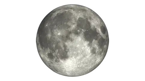
Moon Phase
Full
Estimated Fish Feeding Activity
63%
Good conditions at 63%, with the next bite window worth watching.
Region Locations
Next Bite · Major
Starts: 11:24pm
Bass River Entrance is tracking well at 63%, with a worthwhile bite period approaching.
Air 11.9 C
Pressure 1009.4 hPa
Water 17 C
Sunrise 6:20am
Sunset 7:44pm
Updated 25 Oct 8:26pm
Good conditions at 64%, with the next bite window worth watching.
Air 11.4 C
Pressure 1009.2 hPa
Water 16.7 C
Sunrise 6:19am
Sunset 7:44pm
Updated 25 Oct 8:26pm
Next Bite · Major
Starts: 11:24pm
Good conditions at 63%, with the next bite window worth watching.
Air 11.3 C
Pressure 1009.5 hPa
Sunrise 6:21am
Sunset 7:44pm
Updated 25 Oct 8:26pm
Next Bite · Major
Starts: 11:24pm
Corinella is tracking well at 63%, with a worthwhile bite period approaching.
Air 11.9 C
Pressure 1009.4 hPa
Water 18.2 C
Sunrise 6:21am
Sunset 7:44pm
Updated 25 Oct 8:26pm
Next Bite · Major
Starts: 11:24pm
Good conditions at 63%, with the next bite window worth watching.
Air 11.9 C
Pressure 1009.4 hPa
Water 18.2 C
Sunrise 6:21am
Sunset 7:44pm
Updated 25 Oct 8:26pm
Next Bite · Major
Starts: 11:24pm
Coronet Bay is tracking well at 63%, with a worthwhile bite period approaching.
Air 11.9 C
Pressure 1009.4 hPa
Water 18.2 C
Sunrise 6:20am
Sunset 7:44pm
Updated 25 Oct 8:26pm
Next Bite · Major
Starts: 11:24pm
Grantville Jetty is tracking well at 64%, with a worthwhile bite period approaching.
Air 11.9 C
Pressure 1009.4 hPa
Water 18.2 C
Sunrise 6:20am
Sunset 7:44pm
Updated 25 Oct 8:26pm
Next Bite · Major
Starts: 11:24pm
Jam Jerrup is tracking well at 64%, with a worthwhile bite period approaching.
Air 11.9 C
Pressure 1009.4 hPa
Water 18.1 C
Sunrise 6:20am
Sunset 7:44pm
Updated 25 Oct 8:26pm
Next Bite · Major
Starts: 11:24pm
Good conditions at 64%, with the next bite window worth watching.
Air 11.9 C
Pressure 1009.4 hPa
Water 18.1 C
Sunrise 6:20am
Sunset 7:44pm
Updated 25 Oct 8:26pm
Kilcunda is tracking well at 63%, with a worthwhile bite period approaching.
Air 11.1 C
Pressure 1008.4 hPa
Water 17 C
Sunrise 6:20am
Sunset 7:44pm
Updated 25 Oct 8:26pm
Next Bite · Major
Starts: 11:24pm
Lang Lang is tracking well at 64%, with a worthwhile bite period approaching.
Air 11.9 C
Pressure 1009.4 hPa
Water 18.1 C
Sunrise 6:20am
Sunset 7:43pm
Updated 25 Oct 8:26pm
Next Bite · Major
Starts: 11:24pm
Lang Lang Boat Ramp is tracking well at 64%, with a worthwhile bite period approaching.
Air 11.9 C
Pressure 1009.4 hPa
Water 18.1 C
Sunrise 6:20am
Sunset 7:44pm
Updated 25 Oct 8:26pm
Good conditions at 64%, with the next bite window worth watching.
Air 11.1 C
Pressure 1008.4 hPa
Water 17 C
Sunrise 6:20am
Sunset 7:44pm
Updated 25 Oct 8:26pm
Next Bite · Major
Starts: 11:24pm
Good conditions at 63%, with the next bite window worth watching.
Air 11.9 C
Pressure 1009.4 hPa
Water 16.6 C
Sunrise 6:21am
Sunset 7:45pm
Updated 25 Oct 8:26pm
Next Bite · Major
Starts: 11:24pm
Good conditions at 63%, with the next bite window worth watching.
Air 11.9 C
Pressure 1009.4 hPa
Water 16.6 C
Sunrise 6:21am
Sunset 7:45pm
Updated 25 Oct 8:26pm
Next Bite · Major
Starts: 11:24pm
Stockyard Point is tracking well at 63%, with a worthwhile bite period approaching.
Air 11.9 C
Pressure 1009.4 hPa
Sunrise 6:21am
Sunset 7:44pm
Updated 25 Oct 8:26pm
Next Bite · Major
Starts: 11:24pm
Tenby Point is tracking well at 63%, with a worthwhile bite period approaching.
Air 11.9 C
Pressure 1009.4 hPa
Water 18.2 C
Sunrise 6:20am
Sunset 7:44pm
Updated 25 Oct 8:26pm
Showing 1–6
7 Day Region Outlook
Scroll or swipe across for the daily weather and bite rhythm.
Sun
25 Oct
Slight Rain
13-19 C
Precipitation 90% chance
Solunar
63% activity
Good
Major 10:59am-12:59pm
Sunrise: 6:20am
Sunset: 7:44pm
Mon
26 Oct
Light Showers
11-16 C
Precipitation 0 to 3 mm · 80% chance
Solunar
80% activity
Good
Major 11:50am-1:50pm
Sunrise: 6:19am
Sunset: 7:45pm
Tue
27 Oct
Light Showers
11-16 C
Precipitation 0 to 2 mm · 60% chance
Solunar
78% activity
Good
Major 12:16am-2:16am
Sunrise: 6:18am
Sunset: 7:46pm
Wed
28 Oct
Light Showers
11-18 C
Precipitation 0 to 2 mm · 60% chance
Solunar
65% activity
Good
Major 1:14am-3:14am
Sunrise: 6:17am
Sunset: 7:47pm
Thu
29 Oct
Overcast
13-19 C
Precipitation 0 to 1 mm · 30% chance
Solunar
56% activity
Good
Major 2:15am-4:15am
Sunrise: 6:15am
Sunset: 7:48pm
Fri
30 Oct
Partly Cloudy
12-20 C
Precipitation 0 to 1 mm · 30% chance
Solunar
53% activity
Good
Major 3:19am-5:19am
Sunrise: 6:14am
Sunset: 7:50pm
Sat
31 Oct
Light Showers
14-21 C
Precipitation 0 to 4 mm · 60% chance
Solunar
56% activity
Good
Major 4:23am-6:23am
Sunrise: 6:13am
Sunset: 7:51pm
7 Day Solunar Forecast
Compare daily bite activity, major fish feeding times and moon conditions to help plan upcoming fishing sessions.
Wind
Wind direction and strength can change how exposed a location feels, especially around open water, beaches, piers, and headlands.
Last Reported
Current speed
7.0 km/h
Direction
W
Reading the wind
Wind direction and strength can affect comfort, casting, and exposure around this location.
Wind gusts can be stronger than the average wind speed, so it's worth checking the gust forecast if you're planning to fish from an exposed location or need to know about potential changes in conditions.
Even modest wind can affect comfort and casting, especially where the water is exposed.
The marker shows the current wind direction, while the daily outlook below shows whether conditions are likely to build or ease over the coming days.
Wind forecast unavailable for the coming days.
Last observed
1009.4 hPa
Mean Sea Level pressure · Observed Sun 25 Oct, 7:50 pm local time · BOM
Actual observations from the past 24 hours. Lines stop at gaps or changes in measurement source.
Fishing Report Trends
Bass Coast reports span a broad range of species, with Snapper, Gummy Shark and King George Whiting.
Regional reports can draw from several nearby waters, so the chart should be read as a broad guide.
Based on regional Getfished fishing report species data.
Share of the displayed top 5 species recorded.
Around this area, squid feature again and again.
It is a useful starting point, not a hard ranking.
Built from all-time reported bait mentions: 364 mentions across 1 distinct bait entries.
Share of the displayed top 1 bait recorded.
Seasonal Species
Based on historical reports recorded for Spring across this state.
Seasonal report strength across the shortlisted species.
Snapper
24
Gummy Shark
11
King George Whiting
7
Silver Trevally
4
24 spring reports recorded.
11 spring reports recorded.
7 spring reports recorded.
4 spring reports recorded.
Bait and Lures
Reported tackle can help narrow options, but it is still a guide rather than a rule.
Around this area, squid feature again and again.
Squid
364
It is a useful starting point, not a hard ranking.
Built from all-time reported bait mentions: 364 mentions across 1 distinct bait entries.
Around this area, skirts, small skirts and hardbodies feature again and again.
Skirts
180
Small skirts
180
Hardbodies
90
It is a useful starting point, not a hard ranking.
Built from all-time reported lures mentions: 450 mentions across 3 distinct lures entries.
Today's sunrise is 6:20 am and sunset is 7:44 pm. As a general guide, the hour before and after sunrise and sunset are often among the most productive fishing periods. Today's minor solunar periods overlap both the morning and evening fishing periods.
Bass Coast has lots of fishing spots, including shore, surf, rock, river, and estuary areas. Anderson Inlet near Inverloch is easy to get to, with boat ramps at Maher’s Landing and Inverloch. There are also ramps at Grantville, Venus Bay, and Newhaven. For shore fishing, check out the beaches at Inverloch, Kilcunda, Cape Paterson, and Wonthaggi, or try the rivers. Car parks make it easy to reach the Kilcunda surf beaches, and you’ll find fishing platforms on River Drive at Tarwin Lower. Some places are simple river or jetty spots, while others are more open rock or surf areas.
Spring and summer are the best seasons to catch most fish, especially snapper, whiting, and flathead in the inlets and on the beaches. In autumn and winter, you’ll find more salmon and tailor along the surf beaches at Inverloch and Kilcunda. For gummy sharks, try the deeper surf and channel areas from late summer into autumn. Bream and estuary perch are in the rivers all year, but you’ll have better luck after rain in the cooler months. For the latest tips, check local fishing reports or ask at tackle shops.
Local conditions are important because the area can change quickly between sheltered inlets, river mouths, open beaches, and rock platforms. The entrance bar at Anderson Inlet is dangerous, so only experienced boaters with strong boats should cross it. At Flat Rocks and The Caves, tides can make it unsafe by cutting off your way back to shore. It’s safest to fish these spots at low tide and when the sea is calm.
Fishing is not allowed in Bunurong Marine National Park, which stretches from The Oaks to Eagles Nest and out to the Victorian waters limit. Some areas near Cape Paterson and Wonthaggi also have no-take rules for reef fish. You need a recreational fishing licence for most Victorian waters. There are size and bag limits for key fish species such as snapper, whiting, bream, flathead, and gummy shark. Some species, such as rays and native freshwater fish, have strict rules or may be completely closed to fishing. No-take species include all marine life in Bunurong Marine National Park and reef fish in sanctuary zones. Always check the latest size, bag limits, and rules before you go to help protect local fish and avoid fines. For current fishing regulations and updates, visit the Victorian Fisheries Authority website or ask at local tackle shops.
If you’re fishing from land, choose your spot based on the water and the fish you want to catch. Inverloch has surf, inlet edges, channels, weed beds, and a jetty where you can often catch whiting, flathead, bream, and salmon. Pensioners Corner is best for whiting and bream when the tides are right, while Maher’s Landing is good for casting into the channel for flathead and gummy shark if you use a heavy sinker. The Poles has a weed bed just off the beach that attracts whiting and mullet. The Bowling Club stretch and Inverloch Jetty are easy to reach for bream, trevally, and sometimes tailor. Kilcunda and Wonthaggi are better for surf and rock fishing, especially if you want salmon, tailor, or the occasional gummy shark. Try surf fishing during the day for salmon, or go early or late if you’re after sharks. For river fishing, the Bass, Powlett, and Tarwin rivers are good for estuary fishing near the mouths, banks, and platforms. Bream and estuary perch are the main targets, and you might also find mullet.
Use gear that matches the area you’re fishing. A light line works well on the rock platforms between Inverloch and Cape Paterson when the sea is calm and the tide is low. At Maher’s Landing, you’ll need a heavier sinker to reach and hold in the channel. For bait, try pipis or sandworms for whiting, pilchards or bluebait for salmon and tailor, and squid or cut pilchard strips for gummy shark. Soft plastics and small hard-body lures can also work well for flathead and bream in the estuaries. Basic running sinker rigs or paternoster rigs are popular and effective in most local waters. It’s more important to watch the conditions, access points, and fishing rules than to have lots of tackle.
For safety, always check local tide charts and weather forecasts before you go. The Bureau of Meteorology is the preferred source for up-to-date marine conditions when out on the water. Watch for local warning signs such as a sudden change in wind direction, quickly rising swell, or dark clouds building over the ocean, which can indicate dangerous weather or incoming tides. In some spots, fast-running water or exposed rocks that are becoming covered again are signs that the tide is turning. Pay attention to unexpected drops in temperature or shifting gusts, which can signal a change in conditions. In an emergency, call 000 or contact the Coast Guard for help. Keep your phone with you and know where the nearest car parks and access roads are. Staying informed and prepared helps you stay safe and respond quickly if conditions change.
| Latitude | -38.4348 |
|---|---|
| Longitude | 145.4426
View on Google Maps |
| Nearest city | Melbourne |
| Environment | Saltwater |
| Distance from Melbourne (as the crow flies) | 111.89 km |
| Platform | BeachesPiersRocksToiletsShelterParking |
| Bays | Western port |
Fishing report summaries are derived from Getfished’s structured fishing report database system. More information on this on how we collect and structure fishing report data can be found on our Fishing reports information.
Forecasts are based on the Getfished Meteorological and Solunar Forecasting System, which combines data from the BOM, and other sources. Our custom software systems use these inputs to establish solunar, tides and other forecasts for fishing conditions.
For more information on our systems and data sources please see our Datasources page. You can also Contact us for more information or details on commercial reuse.


